The bastards have switched off viewranger, doesnt work anymore. Gutted as i had paid for 1:25000 maps of all my favourite mtb places. They were bought out by outdoor active and their app is dogshite.
What do people use for os mapping in the uk, and also abroad? Was thinking specifically the French alps. Is there a garmin device thats any good. Got an old one and you have to fuck about with sd cards for the maps. The operating system is a complete pile of rubbish too, drives you mad how complicated it is to work. Viewranger was just brilliant, sad day.
Viewranger RIP
-
porter_jamie
- Posts: 445
- Joined: Sun Apr 05, 2020 8:41 am
- Has thanked: 253 times
- Been thanked: 143 times
- Pirahna
- Posts: 1946
- Joined: Wed Mar 25, 2020 7:31 pm
- Has thanked: 1816 times
- Been thanked: 1164 times
Re: Viewranger RIP
If I were in the UK with decent wifi I'd let you have full UK OS maps for Garmin, but I'm on campsite in Spain with campsite wifi.
I've recently been playing around with OpenMTB maps using Orux Maps for an Android application (tablet and phone) and Garmin Basecamp on the PC for plotting routes. The OpenMTB maps will cost about £15, they work well on my Garmin loading a lot faster than OS. I'm using an Edge 810 at the moment, I've used the OpenMTB maps on a couple of different Etrex devices and they're great on those too. All Garmins at this level use SD cards.
https://openmtbmap.org/
https://www.garmin.com/en-GB/software/basecamp/
https://www.oruxmaps.com/cs/en/
- derek badger
- Posts: 898
- Joined: Sat Mar 14, 2020 1:12 pm
- Location: Surrey Hills
- Has thanked: 769 times
- Been thanked: 1135 times
Re: Viewranger RIP
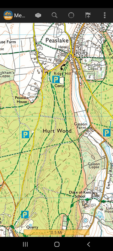
I moved from Viewranger to Memory Map a few years back. Great app. 1:25K and 1:50K OS Topos on annual subscription. Think I got the whole of the UK for thirty quid. You can up load .gpx files that you've created in the desktop app.
Here's Swinley Forest and Surrey Hills for instance.


Here's Swinley Forest and Surrey Hills for instance.


Re: Viewranger RIP
I use Locus Map ( https://play.google.com/store/apps/deta ... roid.locus ) it has an online web planner that pairs with the app. Can use a multitude of maps for many purposes (walking, cycling, vehicles etc.). Has excellent route and track management capabilities and simply far to many features to list here.
Has a bit of a learning curve but well worth the effort in my view.
Unfortunately, only available on Android.
Has a bit of a learning curve but well worth the effort in my view.
Unfortunately, only available on Android.
